Philosophy of Geography
1) Strabo’s Geography
Strabo’s Geography is a comprehensive study of the world and its peoples, written by the Greek historian and geographer Strabo in the 1st century AD. The work is a 17-book treatise that covers a wide range of topics, including the physical and political geography of the known world, the customs and cultures of various peoples, and the history of different regions.
One of the key themes of Strabo’s Geography is the importance of geography in understanding the world and its inhabitants. Strabo believed that a knowledge of the physical and political landscape was essential for understanding the actions and beliefs of a people. He also emphasized the relationship between geography and history, arguing that the location and resources of a region played a crucial role in shaping its history.
Another important aspect of Strabo’s Geography is its detailed descriptions of the various peoples and cultures of the world. Strabo traveled widely and interviewed many people, and his work is filled with firsthand accounts of the customs, beliefs, and practices of different groups of people. He also included accounts of myths and legends from various cultures, which provide valuable insight into the beliefs and worldviews of ancient peoples.
Strabo’s Geography also contains a wealth of information on the physical features of the world, including descriptions of rivers, mountains, and coastlines. He also discussed the climate and natural resources of different regions, and provided detailed accounts of the wildlife and vegetation found in different parts of the world.
Despite its many strengths, Strabo’s Geography also has its limitations. Strabo wrote during a time when the Roman Empire was expanding rapidly, and his work reflects the biases and prejudices of the time. He also relied heavily on the writings of earlier authors and may have repeated errors or misconceptions that were prevalent in his day.
In conclusion, Strabo’s Geography is a monumental work that provides a wealth of information on the world and its inhabitants in the 1st century AD. It is an invaluable resource for anyone interested in the history, culture, and geography of the ancient world. Despite its limitations, Strabo’s Geography remains an important and influential work, and it continues to be studied and referred to by scholars today.
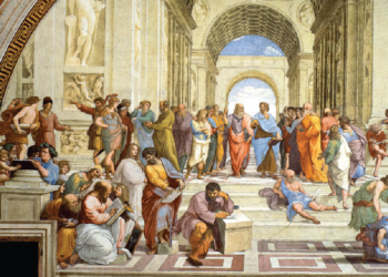
2) Geography in Ancient History
The philosophy of geography in ancient history can be traced back to the ancient Greek and Roman philosophers, who believed that the earth was a living organism and that the study of geography was essential for understanding the natural world.
The Greek philosopher, Pythagoras, believed that the earth was a sphere and that the study of geography was essential for understanding the relationships between different regions and peoples. He also believed that the earth was the center of the universe and that the stars and planets revolved around it. This belief in the spherical shape of the earth was later expanded upon by the Greek mathematician, Eratosthenes, who accurately calculated the earth’s circumference using the shadows cast by the sun at different locations.
Strabo believed that geography was the study of the earth’s surface and the distribution of its inhabitants. He also believed that the study of geography was essential for understanding the political and economic relationships between different regions and peoples. Strabo’s work, “Geographica,” was a comprehensive treatise on geography and remained a primary source of information on the subject for centuries to come.
Ptolemy believed that the earth was a sphere and that the study of geography was essential for understanding the relationships between different regions and peoples. He also believed that the earth was the center of the universe and that the stars and planets revolved around it. Ptolemy’s work, “Geographia,” was an important source of geographical knowledge for the ancient world and was used as a reference for centuries to come.
In ancient history, the philosophy of geography was closely linked to the belief in the natural order of the universe and the importance of understanding the relationships between different regions and peoples. The study of geography was seen as essential for understanding the political and economic relationships between different regions and peoples, as well as for understanding the natural world. This understanding was considered key to the functioning of society, as it allowed for the effective administration of territories and the development of trade routes.
The ancient philosophers of geography also believed that the study of geography could lead to a deeper understanding of the human condition. They believed that the study of different regions and peoples could provide insights into human nature and the ways in which different cultures and societies functioned. This understanding was considered essential for the development of moral and political philosophy.
One of the earliest examples of the importance of geography in ancient history can be seen in the ancient Mesopotamian civilization, which emerged in the Tigris and Euphrates river valleys. The rivers provided fertile land for agriculture, as well as a means of transportation and communication. This allowed the civilization to develop complex systems of government, religion, and trade.
The ancient Egyptians also recognized the importance of geography in shaping their civilization. The Nile river provided water for irrigation and transportation, which allowed for the development of a strong central government and the growth of large cities. The deserts surrounding the Nile valley also provided natural protection against invasion.
In ancient Greece, geography played a key role in the development of city-states. The rugged terrain of Greece made it difficult to unite the many different city-states under a single government, leading to a decentralized system of governance. Additionally, the sea-faring Greeks used their knowledge of the Mediterranean to establish trade networks and colonies, which played a significant role in their economic and cultural development.
The ancient Romans also understood the importance of geography in shaping their civilization. The Mediterranean provided a means of transportation and communication, allowing the Romans to establish a vast empire that stretched from Britain to Egypt. The mountains and rivers of Italy also provided natural barriers that helped to protect the city of Rome.
In ancient China, geography played a crucial role in the development of the civilization. The Yellow and Yangtze rivers provided fertile land for agriculture and a means of transportation, allowing for the growth of large cities and the development of complex systems of government and trade. The natural barriers provided by the Himalayas and the Gobi desert also helped to protect China from invasion.
In ancient history, geography was not only a physical aspect of the world, but also a cultural and political one. The study of geography was essential for understanding the relationships between different regions and peoples, as well as for understanding the natural world. This understanding was considered key to the functioning of society, as it allowed for the effective administration of territories and the development of trade routes.
Geography played a vital role in ancient history, shaping the way that people understood and interacted with the world around them. From the earliest civilizations, geography influenced everything from trade and transportation to political and military strategy. The study of geography was essential for understanding the relationships between different regions and peoples, as well as for understanding the natural world, and it was considered key to the functioning of society.
In conclusion, the philosophy of geography in ancient history played a vital role in shaping the way that the world was understood and perceived. The belief in the natural order of the universe and the importance of understanding the relationships between different regions and peoples were central to the study of geography. The works of ancient philosophers such as Pythagoras, Strabo, and Ptolemy provided a foundation for the study of geography that would be built upon for centuries to come.
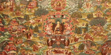
3) Geography in Ancient India
The philosophy of geography in ancient India can be traced back to the Vedic period, where the concept of ‘Akasha’ (space or sky) was central to understanding the natural world. The Vedic texts, such as the Rigveda, suggest that the universe was created from the ‘Akasha’ and that it was the source of all life and movement. The concept of ‘Akasha’ was later developed in the Upanishads, where it was seen as the source of all consciousness and being.
In the ancient Indian philosophy of Sankhya, the universe was seen as a duality of purusha (consciousness) and prakriti (matter). The Purusha is the observer, and Prakriti is the observed. The Sankhya philosophy explains that the Purusha and Prakriti are in a state of equilibrium, and when this equilibrium is disturbed, the universe comes into existence.
The Indian epic Mahabharata, also describes the earth and its regions, it mentions the seven continents and the four oceans. The Mahabharata describes the earth in the form of a disc, with the Himalayas as the center and the four oceans surrounding it.
The Indian philosophers, including the Jain and Buddhist philosophers, also believed that the study of geography was essential for understanding the natural world and the relationships between different regions and peoples. They believed that understanding the geography of a place was essential for understanding the people who lived there and their cultures, customs, and beliefs.
In ancient India, the study of geography was not only limited to physical features of the earth, but it also included the study of human settlements, trade routes, and cultural and economic interactions between different regions. The Indian philosophers believed that the study of geography was essential for understanding the natural order of the universe and the importance of understanding the relationships between different regions and peoples.
Ancient India had a rich tradition of geography, which was closely linked to the study of natural resources, trade routes, and human settlements. The ancient Indian texts, such as the Vedas, the Mahabharata, and the Puranas, provide detailed descriptions of the physical features of the Indian subcontinent, including the mountains, rivers, and oceans.
One of the most significant geographical features of ancient India was the river system. The Indus, Ganges, and Brahmaputra rivers were of great importance in ancient India, as they were the primary source of water for irrigation and transportation. The ancient Indian texts also mention the various tributaries of these rivers, and their geographical location. The river Indus, for example, was considered as the lifeline of the Indus Valley Civilization.
The Indian subcontinent is also characterized by a diverse range of mountain ranges, including the Himalayas, the Vindhyas, and the Satpuras. The ancient Indian texts describe the various peaks and passes of these mountain ranges, and their significance in trade and communication. The Himalayas, for example, were considered as a barrier between India and the Central Asian plateau, and were also the source of many important rivers.
The Indian Ocean, Bay of Bengal and Arabian Sea also played an important role in ancient Indian geography. The ancient Indian texts, such as the Periplus of the Erythraean Sea, provide detailed accounts of the various ports and trade routes along the Indian coast. The Indian ocean was an important route for trade and communication, connecting ancient India with the Roman empire, the Persian Gulf, and the Red Sea.
Ancient India also had a rich tradition of human settlements, which varied from small villages to large cities. The ancient Indian texts describe the various towns and cities, their layout, and the social and economic life of their inhabitants. The Indus Valley Civilization, for example, is known for its well-planned cities and advanced urban planning.
In addition to physical geography, ancient Indian texts also provide an account of the various ethnic groups, and their languages, customs, and beliefs. The ancient Indian texts describe the various tribes and kingdoms that existed in ancient India, and their political and economic relationships with one another.
In conclusion, the geography of ancient India was closely linked to the study of natural resources, trade routes, and human settlements. The ancient Indian texts provide a detailed account of the physical features of the Indian subcontinent, including the rivers, mountains, and oceans, as well as the human settlements, trade routes, and cultural and economic interactions between different regions. The study of ancient Indian geography was essential for understanding the natural and human-made landscape of the Indian subcontinent and the interactions of people with it.
4) Copernican Revolution and Geography
The Copernican Revolution, named after the Polish astronomer Nicolaus Copernicus, marked a significant shift in scientific understanding in the 16th century. It marked a turning point in the history of science, as it challenged the long-held belief that the Earth was the center of the universe, and instead proposed that the Sun was the center of the solar system. This revolution had a significant impact on the field of geography, as it challenged traditional beliefs about the shape and size of the Earth, and the relationships between different regions and peoples.
Before the Copernican Revolution, the Ptolemaic system, which placed the Earth at the center of the universe, was widely accepted among scholars. This system was based on the belief that the Earth was a fixed and immovable object, and that the stars and planets revolved around it. This belief was not only accepted in the field of astronomy but also in geography. It was believed that the Earth was a flat disc, and the oceans and continents were situated around the edges.
The Copernican Revolution challenged this belief by proposing that the Earth was not the center of the universe, but rather that the Sun was the center of the solar system. This meant that the Earth was not a fixed and immovable object, but rather that it moved along with the other planets. This revolution in thinking had a significant impact on the field of geography, as it challenged traditional beliefs about the shape and size of the Earth and the relationships between different regions and peoples.
The new understanding of the Earth as a moving object also led to the development of new methods for mapping and measuring the Earth’s surface. The invention of the telescope in the 17th century, allowed for more accurate measurements of the Earth’s shape and size. Furthermore, the understanding that the Earth was a sphere led to the development of new methods for determining longitude and latitude, which allowed for more accurate maps of the Earth’s surface.
The Copernican Revolution also had an impact on the study of the Earth’s atmosphere. The new understanding of the Earth as a moving object led to the realization that the atmosphere was not static but rather that it was in constant motion. This understanding led to the development of new methods for studying the Earth’s atmosphere, such as the use of balloons and kites to measure atmospheric pressure and temperature.
5) Poetics of Space
The philosophy of geography and the poetics of space are closely related concepts that have been developed over time by different philosophers and scholars. The philosophy of geography is the study of the relationships between human beings and the natural environment, and how these relationships shape our understanding of the world around us. The poetics of space, on the other hand, is the study of how people experience and perceive space and how this shapes their understanding of the world.
One of the earliest philosophers to explore the relationship between geography and space was the Greek philosopher, Pythagoras. He believed that the earth was a sphere and that the study of geography was essential for understanding the relationships between different regions and peoples. He also believed that the earth was the center of the universe and that the stars and planets revolved around it. Pythagoras’s ideas about the earth and the universe had a profound impact on the development of geography as a discipline.
In the 19th century, the German philosopher Immanuel Kant developed the concept of “spatial intuition,” which refers to the way in which people experience and perceive space. He believed that spatial intuition was an essential aspect of human understanding and that it was closely linked to our understanding of the world around us.
In the 20th century, the French philosopher and cultural critic, Michel Foucault, developed the concept of “heterotopia,” which refers to spaces that are neither here nor there and that exist outside of the normal order of things. He believed that heterotopias, such as cemeteries, gardens, and museums, were spaces that allowed people to reflect on the nature of space and the world around them.
The French philosopher Henri Lefebvre, in his book “The Production of Space” argues that space is not only a physical reality but also a social construct. He explains that space is produced by human activity and that it is shaped by social relations, power, and politics. Lefebvre posits that space has a historical dimension, and it is constantly being reshaped through human actions.
In recent years, some scholars have applied the concept of poetics of space to the field of architecture, urban planning and design. They argue that the design of buildings, cities, and landscapes should be approached as a form of artistic expression that seeks to create spaces that are meaningful and evocative.
6) Politics and Geography
Politics and geography have a long-standing relationship, with the study of geography playing an important role in understanding the political landscape of a region. Geography can influence political boundaries, resource distribution, and the development of different societies.
One of the ways in which geography affects politics is through the establishment of political boundaries. Physical features such as mountains, rivers, and coastlines can act as natural barriers, making it difficult for different societies to interact and influencing the development of separate political entities. For example, the Himalayas have historically separated India and China, leading to the development of distinct political and cultural systems in each region.
Another way in which geography affects politics is through the distribution of resources. The availability of resources such as water, arable land, and minerals can shape the political and economic development of a region. Areas with abundant resources may become centers of power, while areas with limited resources may be at a disadvantage. This can lead to conflicts over resources and the emergence of unequal societies.
Geography can also shape the way in which societies develop. For example, coastal regions are often centers of trade and commerce, while inland regions may be more isolated and focused on agriculture. This can lead to the development of different cultures and political systems.
In addition to the physical geography, human geography also plays an important role in shaping politics. The distribution of population, urbanization, and migration patterns can have a significant impact on political systems. For example, urbanization can lead to the development of new political structures and the emergence of new social and economic groups.
The relationship between politics and geography is not one-sided, as politics can also shape geography through policies and actions. Political decisions such as border disputes, territorial expansion, and resource exploitation can have a significant impact on the physical and human geography of a region.
In conclusion, the relationship between politics and geography is complex and multifaceted. Geography can shape politics through the establishment of political boundaries, the distribution of resources, and the development of different societies. At the same time, politics can shape geography through policies and actions that can have a significant impact on the physical and human geography of a region. Understanding the relationship between politics and geography is essential for understanding the political landscape of a region.


