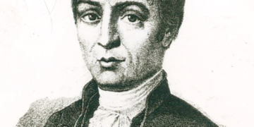
Muhammad Al-Idrisi
1) His biography and His Times:
Al-Idrisi was born in the Moroccan city of Ceuta, and was a descendant of the sharifian Hammudid dynasty, who reigned over Málaga until 1057, and Ceuta and Tangier until 1084. He went to Cordova, the hub of Moslem knowledge in Spain. He travelled extensively in his youth, visiting Asia Minor, North Africa, Spain, France, and most likely the English coast. He proceeded to dwell at the court of Roger II, Norman king of Sicily, at Palermo, not later than 1144, at the request of the latter. Roger’s motivations for inviting him might have been political in nature. Al-Idrisi may have appeared like a valuable weapon in Roger’s plans to consolidate his control over the western Mediterranean, being a descendant of a family governing in Moslem Spain and North Africa and with extensive knowledge of these territories.
Roger, on the other hand, had a strong theoretical interest in geography. He had been supporting an ambitious proposal for a global geography since 1139, based on Greek, Latin, and Arabic geographical literature as well as current news and research. He formed a committee to collect and sort the information. Al-Idrisi rose quickly through the ranks to become one of the great Arab geographers in this capacity.
Al-Idrisi created a silver celestial sphere and a large map of the globe in disc shape cast on a silver base at the King’s request. He wrote his enormous geography of the globe as a critique on it. It was finished in January 1154 and was given the name Book of Roger in honor of the King’s part in its sponsorship.
Al-Idrisi divided the known globe into seven climates in this book, following Greek tradition, and chronicled each clime in detail as it moved from west to east. The narrative is accompanied with a globe map and 70 sectional maps. The Ptolemaic tradition had a stronger effect on his worldview than the Arab tradition, as seen by his maps. Ptolemy’s geography and several works by Arab geographers were utilized as sources by Al-Idrisi, albeit some major ones evaded him.
Al-Idrisi also relied on information from contemporaneous travelers and his own observations in the locations he visited. His account of European nations, for which he had to depend nearly entirely on current sources, is rather unique and typically accurate. The whole text of the Book of Roger has never been revised, despite the fact that an abbreviated edition was published in Rome in 1592 and a Latin translation in 1619. In the early 1970s, Italy was working on a comprehensive edition.
Al-Idrisi published an expanded version of his geography for Roger’s son and successor, William I, after his death in 1154. This work is no longer available. Al-Idrisi departed Sicily in 1161, perhaps as a consequence of anti-Muslim riots in Palermo. Later, he wrote a condensed version of global geography, which still exists in manuscript. Al-Idrisi also composed poetry and a medicinal treatise. He died at Ceuta in 1165, according to a hypothesis based on a shaky source.
2) His Main Works:
For King Roger II of Sicily, the Arab geographer Muhammad ibn Muhammad al-Idrisi (1100- 1165) produced the Book of Roger, a global geography. His book, which marks the conclusion of the classical period of Arab geography, encapsulates much of what it has accomplished.
As well as the maps, Al-Idrisi produced a compendium of geographical information with the title Kitab nuzhat al-mushtaq fi’khtiraq al-‘afaq. The title has been translated as The book of pleasant journeys into faraway lands or The pleasure of him who longs to cross the horizons. It has been preserved in nine manuscripts, seven of which contain maps. An abridged version of the Arabic text was published in Rome in 1592. Beginning in 1970 a critical edition of the complete Arabic text was published.
3) His Contributions to Geography and Cartography:
Geography is concerned with the distribution of various facts and phenomena on the earth’s surface, as well as their areal differentiation in composition and structure, whereas cartography is concerned with the method of expressing and communicating these facts and phenomena using symbols and graphs. As a result, the relationship between these two disciplines is very tight and personal. However, as their respective evolutions progress, they are increasingly diverging from one another. Maps were the sole way to convey the location of geographical information from ancient times through the upper half of the nineteenth century. They were both a necessary component and a useful tool in the study of geography. Since the end of the nineteenth century, geography has been in the process of separating itself into a number of distinct disciplines. Cartography, on the other hand, was progressing in terms of map projection using geodesy and mathematics, drawing technique improvement, and comprehensive topography mapping.
Al-Idris’ service in Sicily resulted in the completion of three major geographic works: (1) a silver planisphere on which a map of the world was depicted, (2) a world map consisting of 70 sections formed by dividing Earth north of the Equator into seven equal-width climatic zones, each of which was subdivided into ten equal parts by lines of longitude, and (3) a geographic text intended as a key to the planisphere. Kitb nuzhat al-mushtq f ikhtirq al-fq, commonly known as Kit Rujr, or Al- Kitb al-Rujr (“The Book of Roger”), was his major work of descriptive geography. Al-Idris compiled it using data from Arabic and Greek geographic literature, as well as information gathered through direct observation and eyewitness testimonies. The king and his Muslim geographer dispatched a group of people, including individuals who could sketch, to other places to observe and report what they observed. Al-Idris finished the work in January 1154, a few months before Roger died.
Al-Idrisi’s writings were translated into Latin and studied all throughout the world. Al-Idrisi, an Arab geographer, directed the development of more than 70 maps. The Mediterranean Sea, northern Africa, Europe, and portions of Asia are shown on this Al-Idrisi map. It is positioned at the top facing south.
4) His Influence on Europe:
In 1145, Al-Idrisi’s career took a turn for the better when he was summoned by Monarch Roger II of Sicily, the Norman king of the island. King Roger II was regarded as a thinker who supported the translation of Arabic and Greek scientific and philosophical books into Latin. He sent Al-Idrisi a letter inviting him to come and stay in Sicily after hearing about his great journeys and geographical accomplishments. King Roger II met Al-Idrisi and convinced him to remain in Sicily. Al-Idrisi used an egg to symbolize the earth in space and described its location in space to him. Al-Idrisi likened the planet to a white-coated egg, noting that the globe was encircled by galaxies in the sky. King Roger II then requested him to construct a map of the globe for him and promised to provide him with everything he needed to complete this monumental task. Al-Idrisi accepted the challenge and got to work on completing this enormous undertaking. To attain his aim, he worked methodically and meticulously.
Al-Idrisi began by constructing a world map and a geographical book beyond anything the world had ever seen. During his 15 years on the island of Sicily, he completed three significant geographic works: A silver planisphere on which was drawn a world map, a world map consisting of 70 sections formed by dividing the earth north of the Equator into seven equal-width climatic zones, each of which was subdivided into ten equal parts by lines of longitude, and finally a geographic text intended as a key to the planisphere. Al-Kitb ar-Rujr (“The Book of Roger”) is Al-outstanding Idrisi’s work of descriptive geography.
Although the silver planisphere has been gone, the maps and book have been preserved. He also attempted to include descriptive and astronomical geography into his work. The NASA named the well-known Mountainous Shoreline of Sputnik Planum on Pluto ” Al-Idrisi Mountains” in honour of this outstanding geographer and cartographer.


