
1) What is Continental Drift?
Continental drift is the scientific theory that explains the gradual movement of Earth’s continents over geological time. The concept was first proposed by Alfred Wegener in the early 20th century, who suggested that the continents were once part of a single, massive landmass known as Pangaea. According to this theory, Pangaea began to break apart about 200 million years ago, and the fragments—now recognised as the continents—slowly drifted to their present locations. This movement is an ongoing process, with continents continuing to shift even today.
The theory of continental drift fundamentally challenged the long-held belief that the Earth’s surface was static and unchanging. Before Wegener’s theory, most geologists believed that continents and oceans were permanent features. Continental drift introduced the idea that the Earth’s crust is dynamic, with large landmasses capable of moving across the planet’s surface. This movement is facilitated by the Earth’s lithosphere, which is broken into several large plates that float on the semi-fluid asthenosphere beneath them. These tectonic plates carry the continents with them as they move.
Several key pieces of evidence support the theory of continental drift. One of the most compelling is the apparent fit between the coastlines of South America and Africa, which seem to match like pieces of a jigsaw puzzle. This observation suggests that these continents were once connected and later drifted apart. Additional evidence comes from the distribution of similar rock formations, mountain ranges, and fossilised species found on continents now separated by oceans. For instance, fossils of the ancient reptile Mesosaurus have been found in both South America and Africa, providing further support for the idea that these continents were once joined.
The theory also explains certain climatic and geological phenomena that would otherwise be difficult to understand. For example, evidence of past glaciations has been found in regions that are now located near the equator, such as parts of Africa, South America, and India. This suggests that these landmasses were once positioned closer to the poles, where glaciations could occur. Similarly, the presence of tropical plant fossils in Antarctica indicates that this continent was once located in a much warmer climate zone.
While continental drift was initially met with scepticism, particularly due to the lack of a plausible mechanism for the movement of continents, it eventually became widely accepted as part of the broader theory of plate tectonics. Plate tectonics provided the missing explanation by describing how the Earth’s lithosphere is divided into tectonic plates that move over the asthenosphere. The movement of these plates, driven by forces such as mantle convection, gravity, and Earth’s rotation, accounts for the drifting of continents.
Continental drift has had profound implications for our understanding of Earth’s history and the processes that shape its surface. It has provided insights into the formation of mountains, earthquakes, and volcanic activity, all of which are related to the movement of tectonic plates. The theory also helps explain the distribution of fossil species and the historical climate changes that have occurred over millions of years.
2) Wegener on Continental Drift
Alfred Wegener, a German meteorologist and polar researcher, is best known for his pioneering theory of continental drift, which he first proposed in 1912. Wegener’s hypothesis suggested that the continents were once joined together in a single supercontinent, which he named Pangaea. Over time, he argued, this massive landmass gradually broke apart, and the continents drifted to their current positions. Wegener’s ideas were revolutionary, challenging the prevailing scientific view that continents and oceans were permanent features of the Earth’s surface.
Wegener’s interest in continental drift was sparked by his observation of the jigsaw-like fit between the coastlines of South America and Africa. This observation led him to investigate other pieces of evidence that could support his hypothesis. He gathered a range of geological and palaeontological data, noting that similar rock formations and fossilised plants and animals were found on continents now separated by vast oceans. These similarities, Wegener argued, could not be explained unless the continents had once been joined together and later drifted apart.
In addition to the geological and fossil evidence, Wegener also pointed to the distribution of certain climatic phenomena as further support for his theory. He observed that coal deposits, typically formed in warm, tropical environments, were found in regions that are now cold and temperate, such as Antarctica. Similarly, glacial deposits were discovered in present-day India, Africa, and South America, areas now too warm for glaciers to form. Wegener reasoned that these climatic anomalies could be explained by the shifting positions of the continents, which had moved through different climate zones over geological time.
Wegener’s theory of continental drift was initially met with scepticism by the scientific community. Many geologists were unconvinced by his evidence and were particularly critical of his inability to provide a convincing mechanism for the movement of the continents. Wegener proposed that the continents ploughed through the denser oceanic crust, driven by forces such as Earth’s rotation and tidal forces from the Moon. However, this explanation was considered inadequate by most geologists, who believed that the forces required to move continents in this manner would be far too great.
Despite the criticism, Wegener continued to refine and defend his theory. In 1915, he published “The Origin of Continents and Oceans,” in which he elaborated on his ideas and presented further evidence to support continental drift. Although the book attracted some interest, it failed to persuade the majority of the scientific community, which remained wedded to the concept of a static Earth. Wegener’s untimely death in 1930 during an expedition to Greenland meant that he did not live to see his theory vindicated.
It was not until the 1950s and 1960s, long after Wegener’s death, that the theory of continental drift gained widespread acceptance. Advances in technology, particularly in the fields of seafloor mapping and palaeomagnetism, provided the missing pieces of evidence that confirmed Wegener’s hypothesis. The discovery of mid-ocean ridges and the recognition of seafloor spreading provided a mechanism for continental drift, while studies of the Earth’s magnetic field revealed patterns that could only be explained by the movement of continents over time.
Today, Wegener is recognised as a pioneer whose ideas laid the groundwork for the modern theory of plate tectonics, which has become the unifying framework for understanding the dynamic nature of the Earth’s surface. While his original concept of continental drift has been refined and expanded upon, the core idea—that the continents are not fixed but are in constant motion—remains a fundamental principle of geology. Wegener’s work serves as a reminder of the importance of challenging established scientific views and the role of persistence in the face of scepticism.
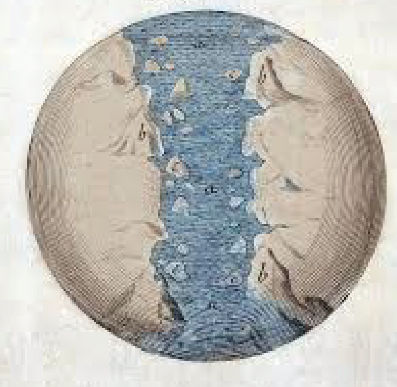
3) Four Evidences: Fit of the Continents
One of the most compelling pieces of evidence supporting the theory of continental drift is the remarkable fit of the continents, particularly the coastlines of South America and Africa. This observation was one of the earliest clues that led Alfred Wegener to propose that the continents were once part of a single supercontinent, Pangaea, and later drifted apart. The concept of the continents fitting together like pieces of a jigsaw puzzle provided a visual and intuitive argument for continental drift, capturing the imagination of scientists and the public alike.
The fit of the continents is most striking when examining the eastern coastline of South America and the western coastline of Africa. When these two continents are brought together, their coastlines align with a high degree of accuracy, suggesting that they were once joined. This observation led Wegener to hypothesise that the continents had been connected in the distant past and had since drifted apart. The idea was further strengthened by the alignment of other continents as well. For example, the southern tips of Africa and South America, along with the landmasses of Antarctica, Australia, and the Indian subcontinent, all fit together in a configuration that supports the existence of Pangaea.
Wegener’s hypothesis was based on more than just a visual fit; he also considered the geology of the continental margins. He found that the rock formations on the coastlines of South America and Africa were remarkably similar, further supporting the idea that these continents were once joined. For example, the Precambrian rock formations found in Brazil are nearly identical to those in West Africa. This geological continuity provides strong evidence that these regions were once part of the same landmass before being separated by the opening of the Atlantic Ocean.
In addition to geological similarities, the fit of the continents is supported by paleoclimatic evidence. Wegener noted that the alignment of continents could explain the distribution of ancient climatic zones, such as the presence of glacial deposits in present-day Africa, South America, and India. These deposits, which date back to the Permo-Carboniferous period, suggest that these landmasses were once located closer to the South Pole, where glaciations could occur. The fit of the continents helps to reconstruct the past positions of these landmasses, providing a coherent explanation for the distribution of ancient climates.
Another aspect of the fit of the continents involves the distribution of fossilised species. Similar fossils of plants and animals, such as the extinct reptile Mesosaurus, have been found on continents now separated by vast oceans. The fit of the continents allows for the reconstruction of a single landmass, where these species could have lived and migrated across connected regions. This biogeographical evidence provides further support for the idea that the continents were once joined and later drifted apart, carrying with them the remnants of ancient ecosystems.
The fit of the continents is not perfect, and some discrepancies exist, particularly when considering the modern coastlines. However, these discrepancies can be explained by geological processes such as erosion, sediment deposition, and sea-level changes that have occurred over millions of years. When the continents are reconstructed using their continental shelves, rather than their modern coastlines, the fit becomes even more precise, reinforcing the idea that they were once connected.
4) Four Evidences: Paleoclimatic Indicators
Paleoclimatic indicators provide crucial evidence supporting the theory of continental drift by showing that the Earth’s continents have experienced significant shifts in climate zones over geological time. These indicators, which include glacial deposits, coal beds, and desert formations, reveal patterns that are difficult to explain unless the continents were once positioned differently on the Earth’s surface. Alfred Wegener used these paleoclimatic clues to bolster his hypothesis that continents were once joined together in a supercontinent and have since drifted apart.
One of the most striking paleoclimatic indicators is the presence of glacial deposits in regions that are now located near the equator. For instance, glacial till and striations—scratches on rock surfaces caused by moving glaciers—have been found in parts of South America, Africa, India, and Australia. These regions are currently situated in tropical and subtropical zones, where glaciers are not possible under present climatic conditions. Wegener argued that the presence of these glacial features could only be explained if these continents were once located closer to the South Pole, where glaciation could occur. When the continents are reassembled into the configuration of Pangaea, these glacial deposits align along a continuous belt, supporting the idea that they were once part of a single ice sheet covering the southern part of the supercontinent.
Another key paleoclimatic indicator is the distribution of coal beds in regions that are now far from the equator. Coal forms from the accumulation and compaction of plant material in warm, swampy environments, typically found in tropical regions. Yet, significant coal deposits have been discovered in areas such as North America, Europe, and Antarctica, which are currently located in temperate to polar climates. Wegener suggested that these coal-bearing regions must have been situated in equatorial zones during the time of coal formation. The drift of the continents over millions of years explains how these coal beds ended up in their current locations, far from the tropical environments where they originally formed.
Desert formations and evaporite deposits offer additional paleoclimatic evidence for continental drift. Deserts are typically found in arid regions within certain latitudinal belts, such as around 30 degrees north and south of the equator. Similarly, evaporites, which include minerals like salt and gypsum, form in hot, dry climates where evaporation rates are high. However, ancient desert sandstones and evaporite deposits have been found in regions that are now located in cooler, more temperate climates, such as parts of North America and Europe. Wegener argued that these features indicate that these continents were once positioned within desert latitudes and have since drifted to their current locations.
The distribution of certain fossilised plants also serves as a paleoclimatic indicator supporting continental drift. For example, the Glossopteris fern, which thrived in temperate climates, has been found in fossil beds across South America, Africa, India, Antarctica, and Australia. These continents are now separated by vast oceans and occupy different climatic zones, but the presence of Glossopteris fossils suggests that they were once connected and located within the same temperate climate belt. This distribution pattern is consistent with the idea that these continents were part of the southern portion of Pangaea, known as Gondwana, where similar climatic conditions prevailed.
In addition to these specific indicators, the overall paleoclimatic patterns revealed by the distribution of glacial deposits, coal beds, desert formations, and fossilised plants provide a coherent picture of continental drift. These patterns show that the continents have not always been in their current positions but have moved across the Earth’s surface, carrying with them evidence of the climates they once experienced. The alignment of these paleoclimatic indicators with the reconstructed positions of continents in the past offers strong support for the theory of continental drift.
5) Four Evidences: Truncated Geographic Features
Truncated geographic features provide significant evidence for the theory of continental drift by illustrating how once-continuous landforms were split apart as the continents drifted to their current positions. These features include mountain ranges, fault lines, and other geological structures that, when the continents are reassembled into their pre-drift configurations, align perfectly across the boundaries of what are now separate landmasses. This evidence suggests that these features were originally part of a single, continuous structure that was divided as the continents drifted apart.
One of the most prominent examples of truncated geographic features is the continuity of mountain ranges that are now found on separate continents. For instance, the Appalachian Mountains in the eastern United States and the Caledonian Mountains in Scotland and Scandinavia were once part of the same mountain range. When the continents are reassembled, these mountain ranges align perfectly, forming a continuous chain that extends from North America to Europe. This suggests that the landmasses containing these mountain ranges were once connected as part of the supercontinent Pangaea. The subsequent drift of the continents caused the breakup of this continuous mountain belt into separate segments.
Another key example of truncated geographic features is the alignment of geological structures across continents that are now widely separated by oceans. The rock formations on the east coast of South America and the west coast of Africa provide a striking example of this. When these continents are placed together, the rock layers and geological structures align seamlessly, indicating that they were once part of the same landmass. This geological continuity across continents that are now separated by the Atlantic Ocean strongly supports the idea that they were once connected and later drifted apart.
Fault lines and other tectonic features also provide evidence for continental drift through their truncation and displacement across continents. The San Andreas Fault in California is part of a larger fault system that extends into the Pacific Ocean and aligns with similar fault systems found on the Pacific Plate. The continuity of these fault lines across what are now separate tectonic plates suggests that they were once part of a continuous fault system that was disrupted as the plates moved apart. This truncation of fault lines and the displacement of tectonic features provide clear evidence of the dynamic nature of the Earth’s crust and the movement of continents.
The distribution of ancient geological formations, such as cratons and shields, also offers evidence for continental drift. Cratons are the stable, ancient cores of continents, often surrounded by younger geological formations. When the continents are reassembled into their pre-drift positions, the cratons of different continents align to form larger, continuous geological provinces. For example, the cratons of West Africa and South America fit together to form a continuous shield, indicating that these landmasses were once connected. The truncation of these ancient geological formations across continents that are now separated by oceans supports the idea that they were once part of a single, unified landmass.
Additionally, the truncation of paleogeographic features, such as river systems and sedimentary basins, provides further evidence for continental drift. Ancient river systems that once flowed across what are now separate continents can be traced and reconstructed to show their original courses. For example, the Amazon River in South America and the Congo River in Africa can be reconstructed to form a single, continuous river system when the continents are placed together in their pre-drift positions. Similarly, sedimentary basins that were once part of the same depositional environment are now found on separate continents, indicating that they were split apart by the movement of the continents.
6) Four Evidences: Fossils
Fossil evidence is one of the most compelling and widely cited supports for the theory of continental drift. The discovery of identical or similar fossils on continents that are now separated by vast oceans suggests that these landmasses were once connected, allowing species to spread across them. Below are four key examples of how fossil evidence supports the theory of continental drift:
One of the most significant fossil discoveries supporting continental drift is that of Mesosaurus, a small, freshwater reptile that lived during the early Permian period, around 300 million years ago. Fossils of Mesosaurus have been found in both South America and southern Africa, but nowhere else in the world. Since Mesosaurus was a freshwater reptile, it is highly unlikely that it could have swum across the vast expanse of the Atlantic Ocean. This distribution suggests that South America and Africa were once joined as part of a larger landmass, allowing Mesosaurus to inhabit regions that are now on separate continents. The separation of these continents through continental drift would have resulted in the current distribution of Mesosaurus fossils.
Glossopteris was a type of seed fern that thrived during the late Paleozoic era, particularly in the Permian period, approximately 250 million years ago. Fossils of Glossopteris have been discovered across several southern continents, including South America, Africa, Antarctica, India, and Australia. The wide distribution of Glossopteris fossils across these continents, which are now separated by vast oceans, suggests that these landmasses were once connected as part of the supercontinent Gondwana. The presence of Glossopteris in these regions supports the idea that the continents were once joined, allowing this plant to spread across a continuous landmass. As the continents drifted apart, the plant’s fossils were left behind on what are now separate continents.
Lystrosaurus was a land-dwelling reptile that lived during the early Triassic period, around 250 million years ago. Fossils of Lystrosaurus have been found in Antarctica, Africa, and India—regions that are now widely separated. The discovery of these fossils on continents that are now far apart suggests that these landmasses were once connected. Lystrosaurus was a terrestrial animal, so it is unlikely that it could have crossed the oceans that now separate these regions. The presence of Lystrosaurus fossils in such diverse locations supports the idea that these continents were once part of a single landmass, which later split and drifted apart due to continental drift.
Cynognathus was a large, carnivorous reptile that lived during the early Triassic period, around 230 million years ago. Fossils of Cynognathus have been found in both South America and southern Africa, further supporting the theory of continental drift. Like Mesosaurus and Lystrosaurus, Cynognathus was a land-dwelling animal, making it unlikely that it could have traversed the ocean separating these continents today. The distribution of Cynognathus fossils indicates that South America and Africa were once connected, allowing this species to roam freely across a continuous landmass. The eventual separation of these continents led to the distribution of Cynognathus fossils on two different continents.
Fossil evidence provides compelling support for the theory of continental drift by demonstrating that similar or identical species once inhabited regions that are now separated by vast oceans. The discovery of Mesosaurus, Glossopteris, Lystrosaurus, and Cynognathus fossils on different continents suggests that these landmasses were once connected, allowing species to spread across them. As the continents drifted apart, the fossils of these species were left behind, providing crucial evidence of the dynamic nature of Earth’s surface and the movement of continents over geological time.